Download DIGITRACK App, free use for the 1st month


DESCRIPTION
DIGITRACK app for Android enables the employment of our personal cell phone as a GPS Tracking device installed in vehicles, motorcycles, crafts etc., Alzheimer Patients, children, pets as well as any favorite persons of us who have the application installed at their Moreover, it is enabled the bi-directional communication between system users, as well as the exchange of positioning, messages and information, as required by an advanced social network.
INSTALLATION
The application could be downloaded either via GOOGLE PLAYSTORE or via the UBILUS Server. Regarding users who have not purchased any GPS tracker, the application is fully functional during the first month of free use. As soon as the first month of free use has been concluded, users cannot transmit data to third parties but they retain the possibility to receive data by them. After the first month of free use, users could gain access to the Server without any limitations, under the condition that they have submitted the respective annual fee. As soon as the annual fee has been purchased, buyers will be asked to enter the IMEI of their cell phone where the application is or will be installed. The cell phone IMEI could be identified if we make a call at *#06# via our cell phone or be transferred to screen “INFO” at the DIGITRACK app.
The application user manual could be downloaded via the respective link at the present webpage.
TECHNICAL SPECIFICATION
- Automatic language selection in accordance to the selected language of the operating systems. Languages available: Greek, English.
- Selection of the entities monitored (mobile phone devices, GPS trackers) via the contact list of the mobile phone.
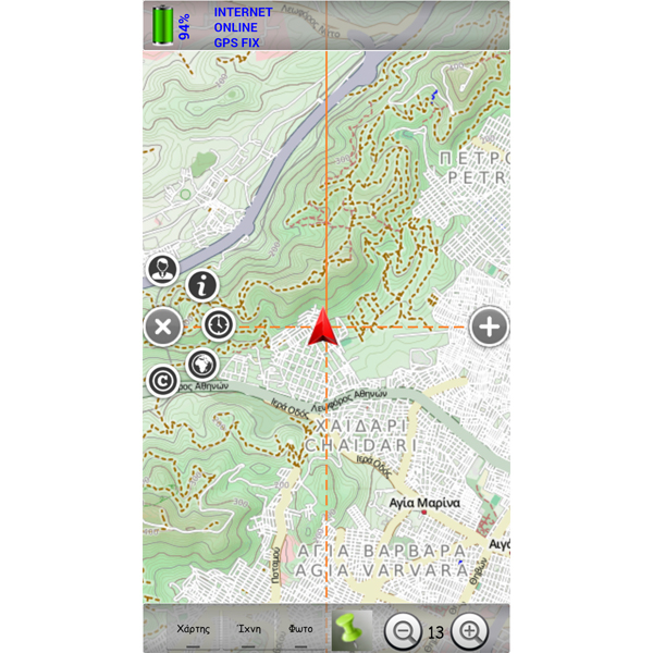
- Track recording and direct (real-time) monitoring of tracking routes progress.
- Use of offline maps and maps storage functionality to the SD card for future use.
- Streetview display at the positions of the entities monitored (WEB).
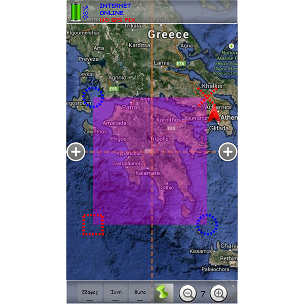
- Display of entities at graphical maps (streets, terrain).
- Display of positions, path traces, distances, directions, entities status (online, offline, within, out of zone).
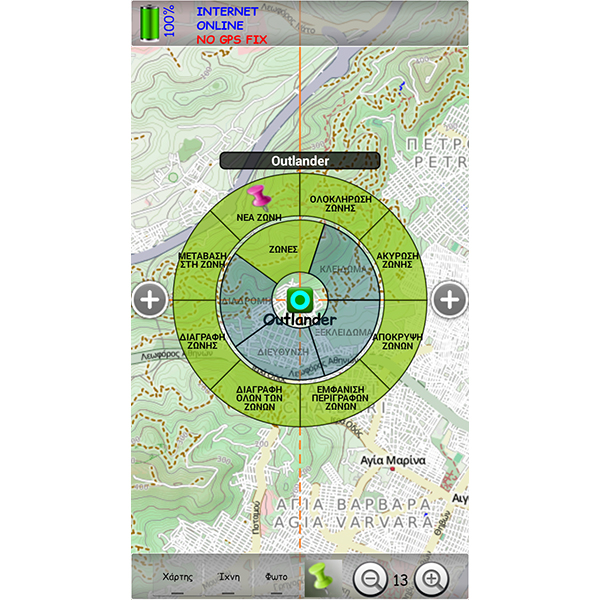
- Zones management function, where possible violations of them, produce immediate alarm.
- Map rotation either in accordance to our movement or to our direction based on electronic compass.
- Display of photo thumbnails, of the entities monitored on the map.
- Zoom In, Zoom Out and Pan Functionalities on the map.
- Access assignment to exchange data with the contacts of user’s choice.
- Display of contacts that have the application installed.
- Underlined contacts that, have recently transmitted unread data, have incoming messages, and are out of zones or out of communication for a long time.
- Transmission of encrypted messages (AES algorithm) between the users, enabled to indicate position on the map.
- Photos transmission as well as simultaneous usage of coordinates by the users.
- Voice communication between the users.
- Route creation starting from user’s position towards any entity, while using relative voice commands. Voice commands in English or in Greek, following the relative language selection.
- Zone management function, zones graphical representation on the map.
- Area management function, enabling areas displayed on the map, where users could to find a route based on their positioning. (Positioning matching to photo).
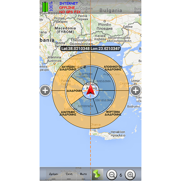
- Route management function, even when “offline”.
- Display of user’s positioning data via the embedded GPS to the mobile phone, as well as of data relative to the mobile telephony cell.
- Positioning – tracks recovery of all entities within a specified time period.
- Playback history, featuring functions such as play, pause, stop, back, forward and simultaneous display of the entities and time on map.
- Graphical representation of GPS satellites, as well as the respective reception level.
- Energy management towards optimized device energy autonomy.
- KML files to be imported to other software applications.
- Battery level, GSM signal level indications.
- Street, number, area of the selected entity, indication along with the respective coordinates display.
- User settings save and restore functionality.
- Real-time alarms based on sensors applicable.
- Sku
- digiapp
- Description
- Digitrack Android Application
- Product Options
# Option Price 1 Digitrack Android €10.00 - Shipping
- Shipping Rate: C